Map
School District Map
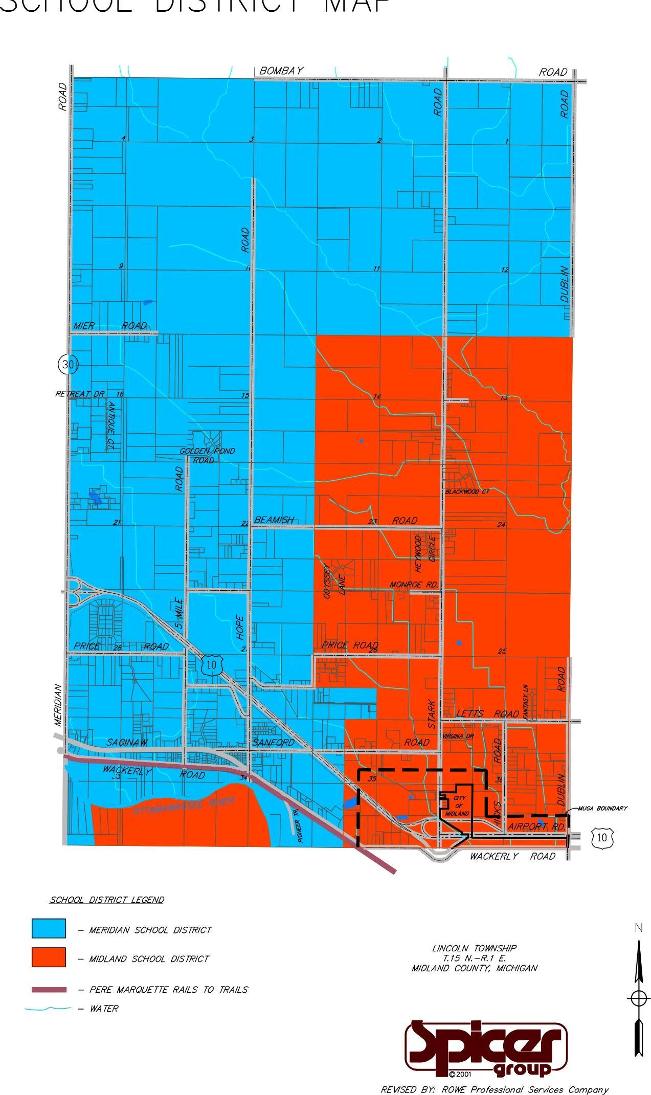
Map of Lincoln Township, Midland County, showing which areas belong to the Meridian School District and which to the Midland School District.
Summary written automatically. The full text below is the record.
School District Map
 (opens the full-size map in a new tab)
Read a text description of this map
Map of Lincoln Township, T.15 N.-R.1 E., Midland County, Michigan, north at top, with section numbers marked in each square mile. Bombay Road is the north boundary, Meridian Road (M-30) the west boundary, Dublin Road the east boundary, and Wackerly Road the south boundary. Other roads labeled include Mier Road, Retreat Dr, Antique Ct, Golden Pond Road, Beamish Road, Monroe Rd., Price Road, Saginaw Road, Sanford Road, Letts Road, Airport Rd., Hope Road, Stark Road, 5 Mile Road, Hicks Road, Pioneer Tr., Heywood Circle, Odyssey Lane, Blackwood Ct, Virgina Dr, Fantasy Ln, and US-10. The Tittabawassee River runs across the southwest corner. Meridian School District (blue) covers the whole township north of the Mier Road line, and the western and central parts south of it. Midland School District (orange) covers the southeastern part: east of a north-south line between Hope Road and Stark Road (closer to Hope Road), from the Mier Road line south to Wackerly Road and east to Dublin Road; south of Price Road it reaches a little farther west. It also covers the land south of the Tittabawassee River in the southwest corner. A dashed line marked MUGA Boundary encloses an area in the southeast near Stark Road and Airport Rd., including a small area outlined and labeled City of Midland. The Pere Marquette Rails to Trails (maroon line) runs along Wackerly Road from the west, then diagonally southeast beside US-10.